AMST 371.01 
Class and Culture
Roger Williams University
M-TH 3:30 - 4:50
GHH 108
Michael R. H. Swanson, Ph. D. 
Office GHH 215
Hours:  M: 9:30 11:00 T-Th 11:00-12:00
Phone:  (254) 3230
E-MAIL  MSWANSON@RWU.EDU
1.The central character of Samaritan is the television writer, Ray Mitchell.  He makes a wonderful protagonist for our purposes because he has experienced so many different social levels in his life.  Throughout the novel, he interacts with a wide variety of people, many of whom could easily be the central character in a story of their own
The Primary Characters:

    these,  consider them a representative sample of kids of that
    age in that environment.
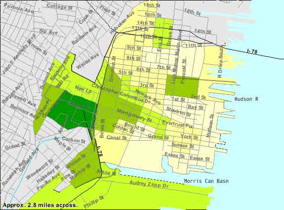
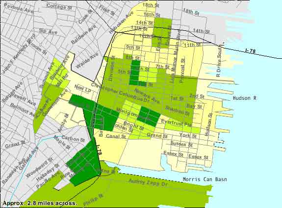
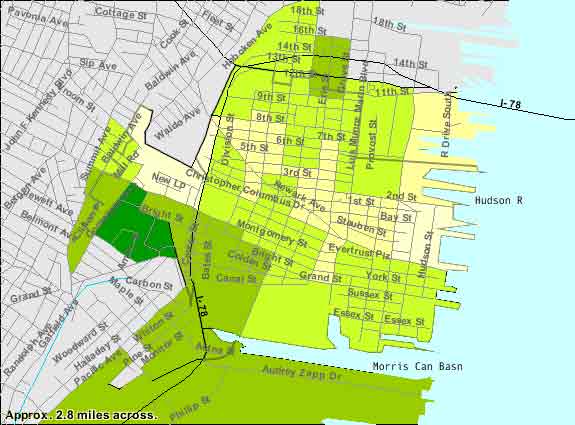
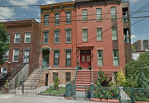
Dempsy, New Jersey, is fictional.  It is modeled, however, upon Jersey City, a very real place.  In order to give you some idea of what Dempsy might be like, I'm providing illustrations of one of the zip codes in Jersey City.  I chose it because it includes a waterfront development similar to the one in which Ray Mitchell lives as well as areas similar to those where the other characters reside.
Percentages of Individuals Living in Poverty. The National Average ia 9.8%
Percentage of population identifying itself  Hispanic.   The National Average ia 12.5%
Percentage of population identifying itself  Black or African-American.   The National Average is 12.3%
Zip Code 07302, Air view courtesy of Google Earth.  The tower to the bottom right would be similar to that described in Samaritan.  A view to the southeast would include the Statue of Liberty. Click on the link above to get sensusdata for the area.

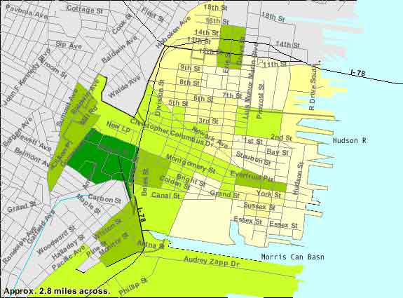
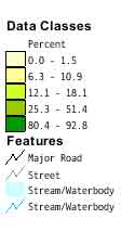
Note the street pattern here.  You'll see that some of the areas described in economic or social terms are outlined by the changes in street orientation.

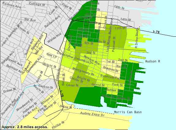
Click on the Picture to open a view from Google Earth.  Google Maops Maps offers a chance to see the part of JerseyCity similar to where Ray Mitchell used to live and where he lives when the story occur.

To get a sense of the neighborhoods in Dempsey (Jersey City) Click on the map to the left.  The neighborhood map at City-Data.com seems to be down, but the neighborhood data is available.
Use Google Earth  or Google Maps  (I like the classic Maps the best) to explore the city further.  Use some of the layers to see what amenities are available, and if there happen to be pictures of the area included..  You should be able to locate at least one public housing project, and place it in the context of the demographic data below..
Percentages of Families Living in Poverty. The National Average ia 9.8%
Percentage of population identifying itself  White.   The National Average ia 75.1%
Prowl around and see if you can fine at least  one homeless shelter or housing project.